


The La Cloche Silhouette Trail is a renowned backpacking trail located in the heart of Killarney Provincial Park, Ontario. Spanning approximately 80 kilometres (50 miles), this loop trail offers a challenging yet rewarding experience for outdoor enthusiasts. The dramatic peaks showcase the rugged beauty of the Canadian Shield landscape. Named after the iconic La Cloche Mountains and the French term “silhouette,” which pays homage to the distinctive skyline the mountains create, this trail promises breathtaking vistas, diverse terrain, and a glimpse into the geological and historical wonders of the region.
Geological & Ecological Significance
Killarney Provincial Park is situated within the Canadian Shield, a vast geological formation that encompasses much of central and eastern Canada. Composed of igneous and metamorphic rock, the Shield is renowned for its rugged terrain and abundant mineral resources. The La Cloche Mountains are among the oldest mountain ranges in North America. Composed primarily of Precambrian rock dating back over a billion years, these rugged peaks have been shaped by millennia of erosion, creating a dramatic backdrop. On clear days, a hiker can see all the way to Georgian Bay from the mountain peaks.

During the last Ice Age, glaciers sculpted the landscape of Killarney, leaving behind the characteristic granite ridges and rugged topography seen today. The trail traverses terrain shaped by these ancient glaciers, with evidence of glacial striations and moraines visible along the route. Smooth granite outcrops, towering cliffs, and massive boulders dot the landscape, serving as reminders of the region’s tumultuous geological history. The trail also winds its way through dense boreal forests characterized by a mix of coniferous and deciduous trees. Towering white pines, majestic red maples, and fragrant balsam firs provide habitat for diverse wildlife, including moose, black bears, and white-tailed deer.
Historical Significance
Along the trail, hikers can discover remnants of the region’s rich cultural heritage. From ancient Indigenous campsites to relics of early European settlers, such as logging camps and pioneer homesteads, these historical sites offer insights into the human history of the area.
The region surrounding Killarney has been inhabited by Indigenous peoples for thousands of years. The Ojibwe First Nation, in particular, has longstanding ties to the land, with archaeological sites and traditional territories found throughout the area. The trail passes near several Indigenous cultural sites, providing opportunities for hikers to learn about the rich cultural heritage of the Anishinaabe people.

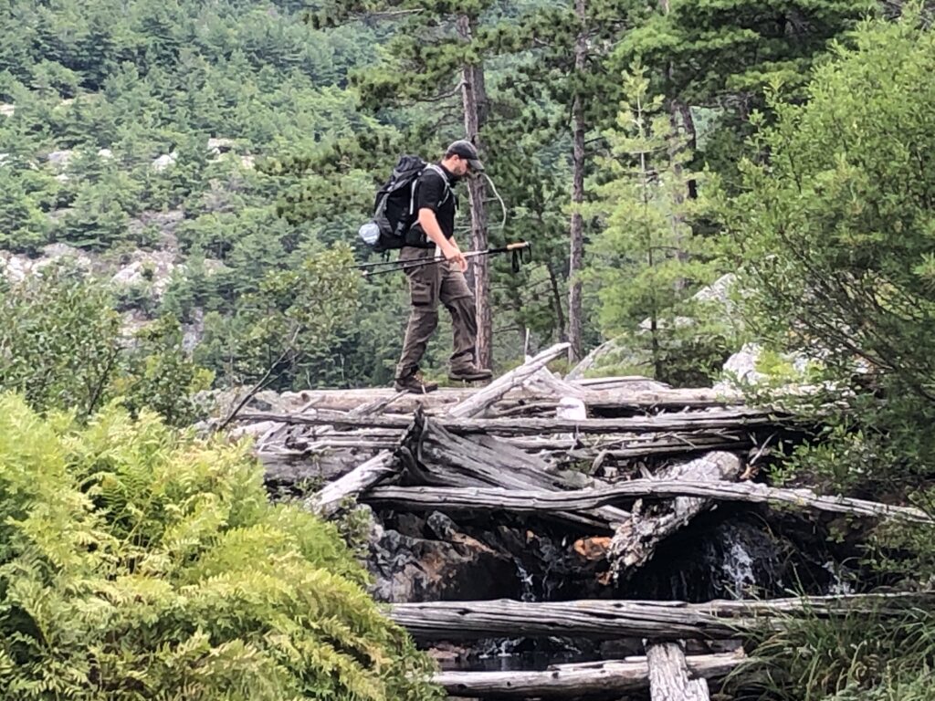
In the late 19th and early 20th centuries, the forests of Killarney were exploited by logging companies seeking valuable timber resources. Remnants of this logging era, including abandoned logging camps, sawmills, and tramways, can still be found along the trail, serving as reminders of the region’s industrial past.
In 1964, Killarney Provincial Park was established to protect its natural and cultural heritage for future generations. Since then, the park has become a haven for outdoor recreation, wilderness preservation, and scientific research. The La Cloche Silhouette Trail plays a vital role in promoting conservation and fostering a deeper appreciation for the park’s ecological and historical significance.
The Trail
We have hiked the full length of this trail 3 times, in 2017, 2018 and 2020. We have completed the trail in both directions, so a lot of the information in this next section will be based upon those experiences. While the park suggests 7-10 days to complete this trail, we’ve done it all 3 times it in 5 nights, 6 days and 4 nights, 5 days. We have stayed at many different campsites along the trail, but we definitely have our favourites!
Western Side
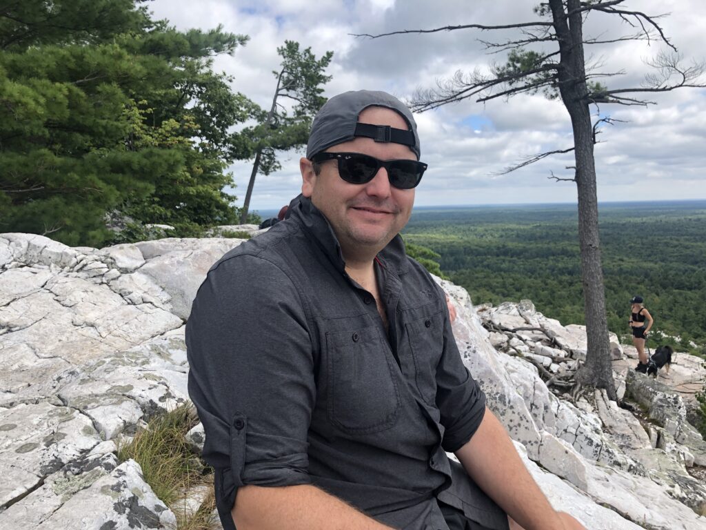
Starting from the George Lake Campground, hikers have the option to hike the trail clockwise or counter clockwise. Traditionally, most backpackers hike in a clockwise direction. However, there are pros and cons to both. For example, the first approximately 30 kms from George Lake Campground to the northern side of Threenarrows Lake, in the clockwise direction, contain fewer dramatic climbs and descents than the remaining portions of the trail. The only exception to this is the main climb at the beginning of the trail and “The Pig” portage. For this reason, most backpackers prefer to start their hike with this section, as it is easier to do with a full pack. One more reason we liked hiking the trail clockwise was being able to have lunch at the top of The Crack on our last day. The spectacular view was the perfect way to celebrate our “almost” completed hike. Having said that, hiking up The Crack on the first day and having our first break at the top was also a great way to start the trip. Then, coming down through the “easy stuff” on the other side of the trail with lighter packs felt like we were flying.
While the first 30 kilometres of the trail from George Lake Campground to Bodina Lake is not as dramatic as the middle section of the trail, it does have its challenges. Right at the beginning, there is a large climb and descent. From there, the next large climb is “The Pig” portage between kilometres 7 and 9. In this section, you will also find the remains of logging encampments. Threenarrows Lake, formerly known as Long Lake, owes its existence to these historical logging activities. In 1900s, the construction of a dam across Kirk Creek transformed the landscape, merging three existing lakes and raising the water levels. This expansive reservoir facilitated the transportation of logs over long distances so operations could extend further eastward. In 1934, Mr. Fred D. Coppock, an affluent industrialist from Ohio, reconstructed the dam in exchange for leasing Doris Island.
The North
The north portion of the trail, from Threenarrows Lake to David Lake, is the most challenging portion of the trail. You will notice your climbs and descents become more and more steep and extreme. Your first major descent and ascent will be around the waterfall. The ascent at Moose Pass is particularly challenging.
The first time we hiked the trail, this pass almost made me quit. I vividly remember getting to about 10 metres from the top and sitting down on a rock and bawling my eyes out that “I can’t backpack”. However, a small pep talk from Jeremy and an electrolyte gummy later, I made it to the top, enjoyed the view and worked up the courage to persevere. Since then, my favourite part of this section has
become walking the ridgeline between Little Mountain Lake and David Lake. In this area, you are up on top of the white granite mountains for much of the hiking, giving you epic views for a good stretch.
While you will experience multiple, steep ascents and descents that are measured in the 100s of metres, the epic views from the white tops of the mountains are a worthy reward for your hard work. Almost all of the lakes on the trail are easily swimmable, and most campsites are right on the water. For us, this is motivation enough to propel us through the hard ups and downs of a day’s hike. Sometimes, we would get up early in order to have lunch at a swimming spot and relax in a lake after lunch before moving with the second half of our day.
The Eastern Side
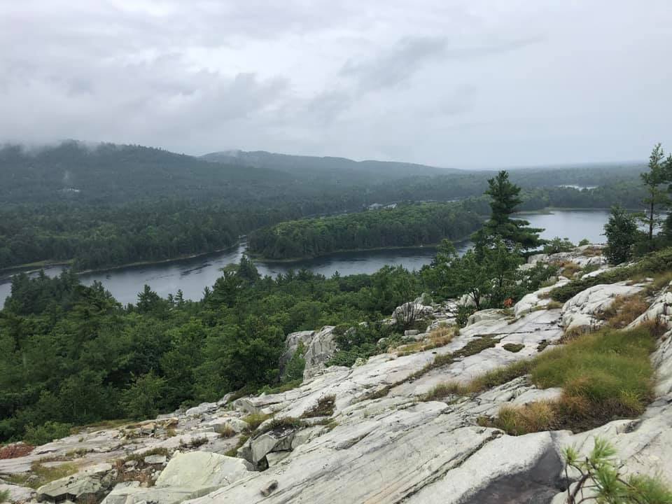
The section from David Lake to the top of The Crack is no less challenging than the northern section. Be careful around the intersection with the Silver Peak trail here, as it is easy to get turned around. This area features lots of hemlock forests, fragrant pines and rocky mountaintops. The lakes in this section are some of the clearest in the park and make for great swimming.
Continuing to head clockwise, the trail leading from the bottom of The Crack back to the George Lake Campground is also free of significant ascents and descents. The last 7-8 kilometres of the trail will take you in between lakes, through boggy marshlands and over beaver dams on your way back civilization. Right before the end of the trial, you will come to one last ascent and descent. This is the last epic view of the trail before returning to the front country.
What to expect at campsites
Every campsite has a designated fire pit constructed of local rocks. They are also each equipped with a “thunderbox”, which is basically just a box with a seat overtop of a hole in the ground where you can take care of your essential “business”. Most sites are located on a lake with access to water. Many of the lakes are excellent for swimming and we usually try to ensure we get to camp with plenty of time for this activity. Backcountry campsites do not have bear boxes, so you will need to hang your food in a tree.
Planning Your Trip
Killarney is a very popular destination, so you will want to plan well in advance. You can book your sites online at the Ontario Provincial Parks reservation site. Here is a spreadsheet you can use to help you quickly calculate distances between campsites.
Campsites We Love: Campsites we avoid: Campsites with steep water:
Best View: Heaven Lake #47 #8 Kirk Creek – Lots of bugs #17,18: Threenarrows Lake
Best Overall: David Lake, #34 #59 Bodina Lake – boggy lake #22: Moose Pass
Best Swimming: Topaz Lake #7 #23 Moose Pass – in forest, no good water #46: Bunnyrabbit Lake
Bunnyrabbit Lake #45,46 #48: Proulx Lake
We really like Jeff’s map for our trip planning. It has lots of details, including expected hiking times for beginning, average and veteran backpackers. It has accurate kilometre markings as well as historical facts and details.
The La Cloche Silhouette Trail offers an unforgettable journey through the rugged beauty of Killarney Provincial Park, showcasing stunning landscapes, geological wonders, and rich historical heritage. Whether you’re an avid hiker, nature enthusiast, or history buff, this trail provides an immersive experience that celebrates the natural and cultural treasures of Ontario’s wilderness. As you embark on this adventure, take time to marvel at the ancient mountains, explore hidden historical sites, and connect with the untamed beauty of the Canadian Shield.
Backcountry sites can be booked online through the Ontario Parks Reservation System.